Research Areas


Glacier Environmental Change
Mountain glaciers play a critical role in local hydrology. Understanding how these glaciers are changing, and their impact on downstream hydrology is thus of critical importance. Much of my work to date has focused on the Tropical Andes, in particular the Peruvian Cordillera Blanca.
Using unmanned aerial vehicles that I custom designed for high altitude (>5000m) operation I have completed repeat surveys of a number of glaciers in the Cordillera Blanca. I have used this data to investigate glacier motion, surface controls on down wasting and total volume loss. Traditional methods of estimating mass balance such as ablation stakes are difficult over debris covered glaciers as a result of the highly heterogeneous rates of change and accessibility. Additionally, quantifying changes over these small glaciers is difficult using remote sensing products such as Landsat and MODIS which are often too coarse to detect small annual changes. You can read about the results of this research in The Cyrosphere, and also by following the links on my news & media page.
We are using similar techniques to understand glacier changes in Huancayo, Peru; and have recently deployed a balloon platform to map a rock glacier in Great Basin National Park, Nevada. In addition I have been involved in the collection of terrestrial LiDAR scans of a glacier on Volcan Chimborazo, Ecuador. I am currently starting work on the Tasman/Haupapa Glacier, in New Zealand’s Southern Alps.
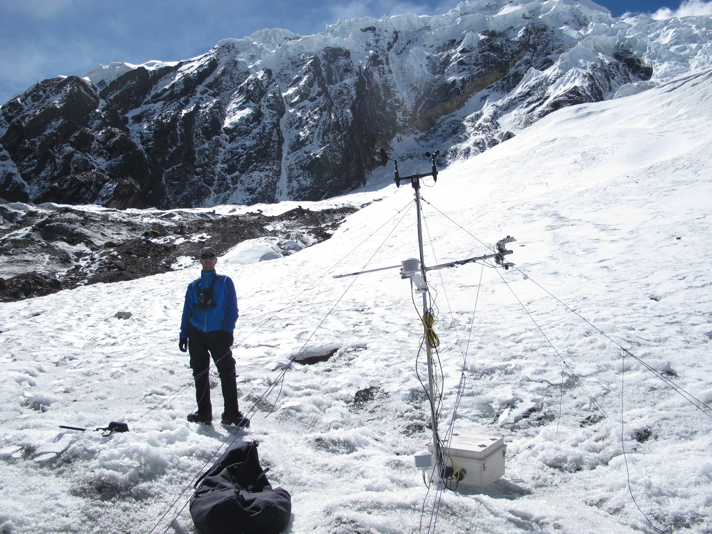
To understand the local and regional hydrology of the Tropical Andes it is critical to quantify meteorologic and hydrologic fluxes. For my soil moisture/ecohydrology research I draw heavily on the network of automatic weather stations, discharge gauges and groundwater wells that my advisor Dr. Bryan Mark (The Ohio State University) has established throughout the Cordillera Blanca. I have been involved in the maintenance, installation and expansion of this unique observation network as well as the establishing of temporary 'on glacier 'weather stations for research into the energy budget of Tropical Glaciers. Further, I have been involved in synoptic sampling campaigns to quantify glacier meltwater input to the Rio Santa basin through hydrochemical end member mixing analysis, trace metal contaminant sampling, and the measurement of river discharge through a variety of methods (e.g. salt dilution, ADCP, etc). A sample of publications related to this work can be found below:


Mountain Ecohydrology
Mountain regions are a critical component of the hydrologic system. These regions are extremely heterogeneous, with dramatic topographic, climatic, ecologic and hydrologic variations occurring over very short distances. These regions are also temporally heterogeneous, with seasonal snow packs and cold winters impacting water storage, release, and vegetation productivity. This spatiotemporal heterogeneity leads to 'hot spots' and 'hot moments' across the alpine landscape, whereby some areas and some times are responsible for the majority of the ecosystem fluxes we observe at a catchment/regional and weekly/monthly/annual scale. This heterogeneity makes understanding changes in these environments difficult. My research seeks to bridge this knowledge gap through the novel integration of field observations, high spatial and temporal resolution UAS data, and traditional earth observing remote sensing platforms (e.g. Landsat, Sentinel, etc).
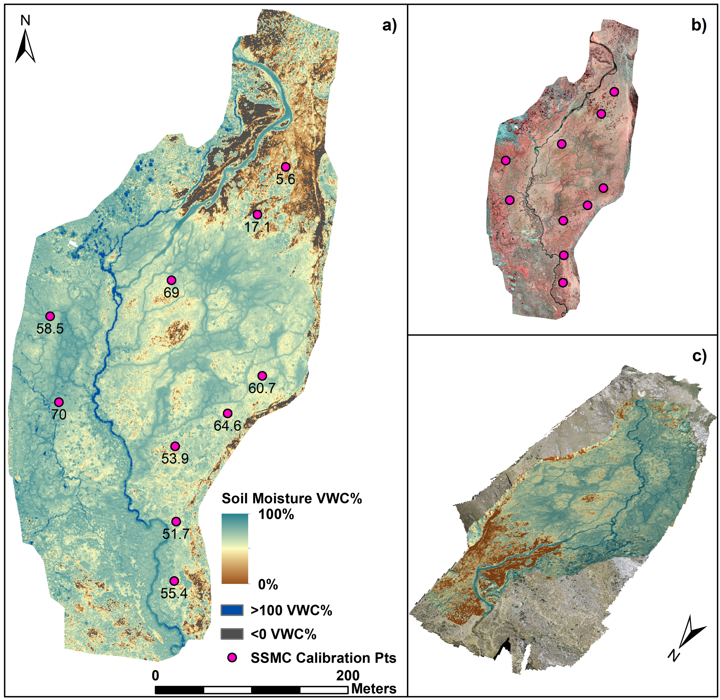
I have been involved in a number of research projects throughout Peru and Bolivia. My dissertation research, in the Cordillera Blanca, Peru, developed new methods for estimating soil moisture from UAS at centimetre resolution. I then combined these data with groundwater wells and meteorological sensors to investigate the role of soil moisture in buffering dry season stream flow.
For my postdoctoral research I am working in the Colorado Rockies at the Niwot Ridge Long Term Ecological Research (LTER) site, at the headwaters of the Boulder Creek watershed. Here I am using UAS to map snow depth and vegetation productivity (NDVI) at weekly interval over an 80ha study catchment. I combine these data with point measurements from a distributed sensor network and satellite observations to investigate spatial variability in snow deposition and energy vs hydrologic limitations on alpine vegetation productivity.
You can find more information about my research in this area here:

High Altitude UAS Design and Deployment
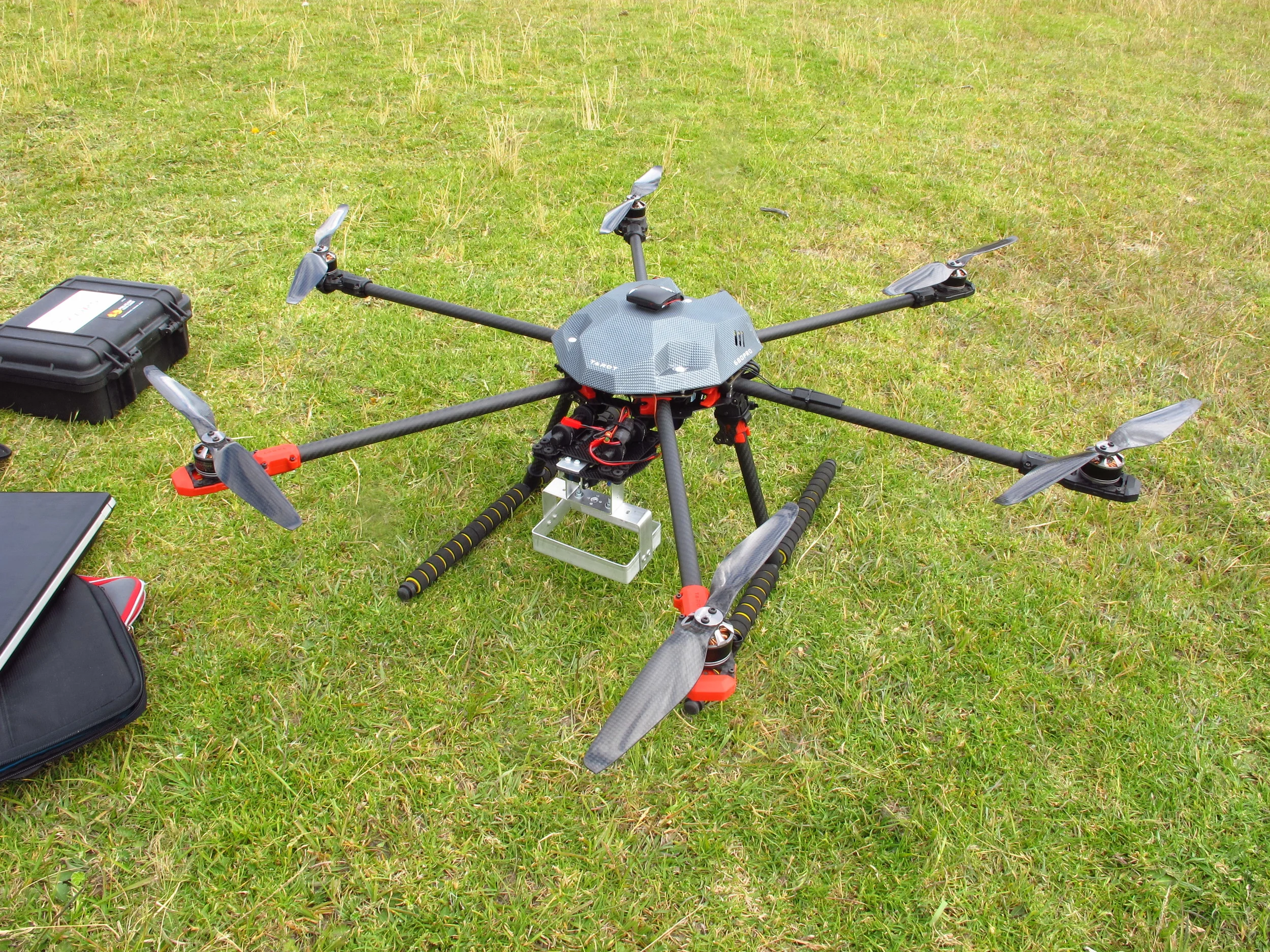
A significant component of my research is related to the design, development and deployment of unmanned aerial systems (UAS) that are capable of operating in high mountain environments. In the Andes my study sites are typically between 4000-5500masl, which makes operating off the shelf unmanned aerial vehicles (UAV's) almost impossible. To remedy this I have designed and built a number of multirotor platforms capable of operating successfully at over 5000masl. I have also deployed kite and balloon based systems, and am currently working on fixed wing platforms. These platforms are fitted with a number of different sensor payloads including cameras that collect data in the visible (RGB), near infrared (NIR) and thermal infrared (TIR) spectrum. Imagery is processed using Structure from Motion algorithms and high accuracy GPS. Using this method we are able to generate high resolution digital elevation models and orthomosaics of the land surface as well as go beyond this to look at non visible variables such as plant health, soil moisture storage, as well as surface and subsurface hydrologic pathways. The possibilities of this technology in earth science research are limitless!
Results of this research have been disseminated widely through news media including in Science Magazine, as well as presented at annual meeting of the Association for American Geographers and the American Geophysical Union, and in the publications below:

Remote Sensing and GIS
In addition to high resolution UAS data, I work with other remote sensing products e.g. aerial photos, Landsat, Planet (Cube-Sat) and LiDAR. My research in this area is primarily using these data to investigate changes in the earth surface (e.g. glacier volume), land cover and land use. I am also refining the ways in which traditional remote sensing algorithms can be applied to low flight elevation high resolution UAS imagery, and working on integration of terrestrial and airborne photogrammetry.
In addition to remote sensing I work extensively with GIS. I draw on my experience in both the academic and commercial world, where I was previously employed as a GIS analyst for mining/environmental and archaeological consultancies.
Examples of some of my research can be found here: